NASA/JPL/University of Arizona
Nel 1971 l’allora Unione Sovietica lanciò verso Marte le missioni Mars 2 e Mars 3. Ognuna di esse consisteva in un ‘orbiter’ e un ‘lander’.
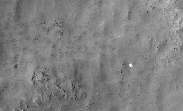
Entrambe le missioni delle sonde orbitanti furono un successo, nonostante la superficie di Marte fosse oscurata da una tempesta di sabbia su scala planetaria. Il modulo di atterraggio della Mars 2 si schiantò al suolo ma la Mars 3 ebbe successo nell’effettuare il primo atterraggio morbido sul Pianeta Rosso. Sfortunatamente, dopo soli 14 secondi e mezzo le trasmissioni si interruppero, per ragioni sconosciute. Il sito previsto per l’atterraggio era situato a latitudine 45 sud e a longitudine 202 est, all’interno del cratere Tolomeo. Nel novembre del 2007, la camera HiRISE della MRO ha ripreso un’immagine ad alta risoluzione di questo sito. L’immagine PSP_006154_1345 è composta da 1,8 miliardi di pixel, per cui sarebbero necessari 2.500 schermi di computer di normale dimensione per vedere l’immagine intera a piena risoluzione! Solo molto di recente nell’immagine sono stati rilevati dei manufatti che sembrano risalire al lander del Mars 3.

NASA/JPL/University of Arizona
The Soviet Mars 3 lander hardware may have been found by Russian citizen enthusiasts following NASA’s Curiosity rover.
In 1971 the former Soviet Union launched the Mars 2 and Mars 3 missions to Mars. Each consisted of an orbiter plus a lander. Both orbiter missions were successful, although the surface of Mars was obscured by a planet-encircling dust storm. The Mars 2 lander crashed but Mars 3 became the first successful soft landing on the Red Planet. Unfortunately, after just 14.5 seconds transmission from the lander stopped, for unknown reasons. The predicted landing site was at latitude 45 degrees south, longitude 202 degree east, in Ptolemaeus Crater. MRO’s HiRISE camera acquired a large image at this location in November 2007. This image, PSP_006154_1345, contains 1.8 billion pixels of data, so about 2,500 typical computer screens would be needed to view the entire image at full resolution. Promising candidates for the hardware from Mars 3 were found only very recently.
Source/Continue reading → hirise.lpl.arizona.edu


